We've made two visits to
Bryce Canyon National Park... The first time was on a trip in 2015 when we went there on a whim while visiting Zion. We didn't have much time so we just hit the view points on the rim of the canyon.
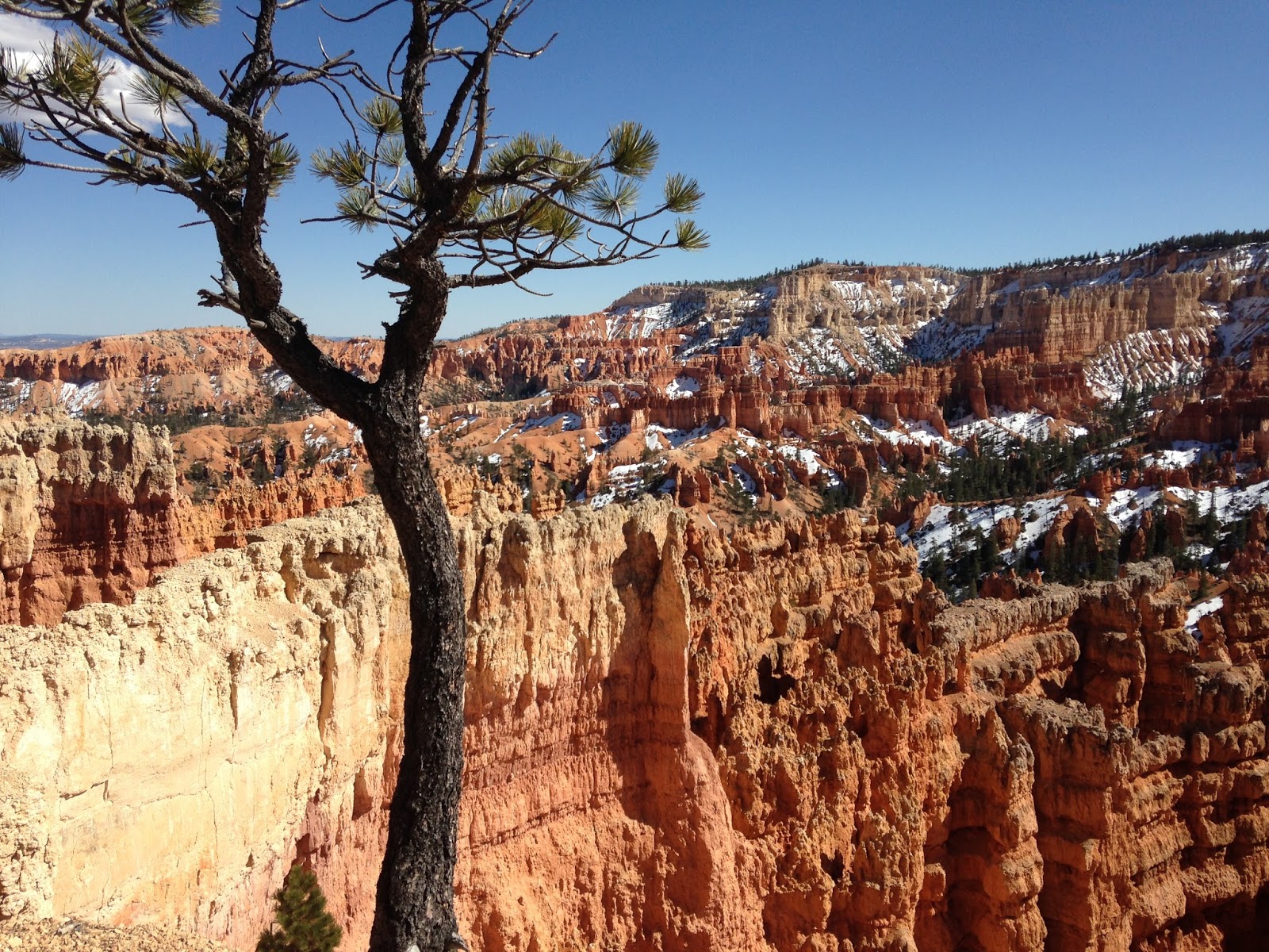
And just from that few hours we knew that we'd have to come back when we had more time. The views were amazing. Bryce Canyon is famous for it's
hoodoos, the tall spires of rock.
Our visit in 2015 was in March and the winter's snow was still lingering in the canyon. Many of the hiking trails were still closed, but we didn't have time for hiking on that trip anyway.
Even if someone is unable to hike much, just viewing the canyon from the viewpoints on the rim is well worth the effort.
In 2017 we made another swing through southern Utah, this time coming from the east. Based on the research I had done on
TripAdvisor I knew that we wanted to check out the
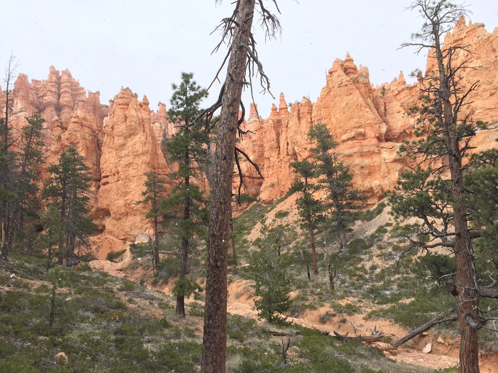
Mossy Cave Trail just off of Highway 12. (And just a tip... If you are coming to Bryce from the east, say from Moab, you want to take Highway 12 from Torrey. Talk about scenic!)
From the small parking area a trail heads off following a small stream, crossing it twice on bridges. Since the trail is so easily accessed and is not a long hike, I planned on there being crowds of people enjoying the sights. But it was almost like we had the place to ourselves.
We passed one couple when we were going up and had another couple wandering around at the falls. On the way out we passed a small family headed up.
The goal was the waterfall. I can not image a more perfect location. I could've spent hours just sitting here; but we had a lot more we wanted to see and do.
As we came into the Park on Highway 63 we made a stop at the Bryce Canyon Visitor Center. I have found the Visitor Centers at our National Parks are all well put together and well worth a stop. But again, we had a purpose & a plan and had to get to it.
Our goal was to get below the Canyon rim. The Canyon is laced with trails for hiking. There's also some horseback options. We decide to put our limited physical abilities to the test and do the Queens Garden Trail and connect to the Navajo Trail.
This route would be about 3.2 miles. Basically it worked out to 1.3 miles of going down into the canyon and 1.8 miles coming back out. The elevation change was about 550 down and 550 back up.
And as impressive as the view from the Canyon rim was, being down among hoodoos was awesome. The rock formations towering over you made you realize how small you really are...
We started the Queen's Garden trail at Sunrise Point, leaving our car in the parking lot near the general store.
Coming down at the beginning of the trail the way we did we saw minimal traffic until we were coming back up out on the Navajo Trail. I'm amazed at how few people want to wander more than a few hundred yards away from their cars. Look people, we are fat and we do it... Get out there and enjoy God's creation!
The trail was well established and easy to follow. And of course the views continued to amaze.
Obviously you'll want to bring plenty of water. Also, there were no restrooms along the way, so plan accordingly.
Have good walking shoes. And if it's hot, don't be afraid to stop and rest.
We didn't plan it, but we had some great sunlight for coming back up. And this was the busiest part of the trail. Many people start from this end at Sunset Point and just go down and back up. The trail here is a series of switch backs where you painfully pay for each foot of elevation.
Slowly you wind back and forth. Since this was the end of our hike we were pretty much at the end of our strength. Plus we had walked a couple of miles earlier that day at the Mossy Cave Trail. Plus the walking we had done in the previous days at Capital Reef National Park, Arches National Park, Canyonlands National Park & Goblin Valley State Park.
So we were moving pretty slow. There was a couple of bus loads of teens coming back zooming past us. But you just keep putting one foot in front of the other....
And of course pausing often to admire the views...
After reaching the top at Sunrise Point, we made our way back only the Canyon Rim trail to Sunset Point and our car.