Showing posts with label desert. Show all posts

Sep 18, 2015

Valley of Fire Revisited - The Fire Wave


In late 2012 we visited Valley of Fire State Park in southern Nevada. It was part of a day trip from Las Vegas that included time at the Hoover Dam. We took longer at the Dam than we had plan so we had to rush through Valley of Fire during the last few hours of daylight.
We loved Valley of Fire and knew that we would have to do a return trip, only this time we wouldn't rush it.
You can see our pictures from our first trip to Valley of Fire here..
And our time at the Hoover Dam can be seen here...
In late March of this year (2015) we were able to do another trip to the southwest, and this time we blocked out a whole day for Valley of Fire.
I know most people go to Las Vegas to drink and gamble. We go for everything else. Great food, good shopping and the unparalleled desert scenery.
Valley of Fire is just an hour's drive from Las Vegas. There are tour companies that you can go with... But I always prefer having a rental car. That way I can explore at the pace that I want to go and see what I want to see. However, no matter how you get there, it's worth the trip.
On our last trip we we able to spot some big horn sheep. We went to the same spot on this trip but we couldn't get lighting to strike twice. The best we could do was to spot this little lizard. Christy initially saw him as he scurried under a rock. After some patient waiting he came out and we got a good look at him.
Our main destination on this trip was a natural phenom know as the Fire Wave. The hike in is a little over a half mile each way. Being there in late March meant it was warm out but not the scorching heat of summer. Anytime of year you'll want to stay well hydrated.
I'm sure there's some fancy way to describe the geology that created this amazing display... But who cares. It's so beautiful that you aren't too worried about how it happened.

About the pictures: you can click on any of them to see a larger picture. I'm not much of a photographer and I don't know if the lighting at the time was the best. So these pictures do not do it justice... But hopefully they'll give you a taste...


If I lived in Vegas, I think Valley of Fire would be a regular destination for me. There's multiple hiking trails taking you to scenic vistas. But even if you don't hike, just driving through gives you stunning views.
It's almost overwhelming. Our trip was 6 months ago but I just now got around to going through the hundred's of pictures to put together this post....


Apr 19, 2015

Death Valley National Park


On March 23rd, as part of vacation to southern Nevada, we did a day trip drive through a portion of Death Valley National Park. The park is made up of over 3 million acres and you could spend several days exploring the whole thing. As well as being a natural wonder, it also has a rich history of man's ability to adapt to any environment.
For a guy born in the foothills of Cascade Mountains of Oregon and raise in a temperate rain forest in Alaska, I sure do love being in the desert. Maybe because it's different than my usual surroundings, but whatever the reason, the desert certainly has a beauty to it.
We started our day in Las Vegas. We got an early start to maximize our time in the daylight hours. Being late March, we knew the temperatures would be too bad. The warmest it got was 95 degrees. Not that 95 degrees isn't hot...  But it's a lot cooler than the 116 degrees it averages in July.
 
We drove to Pahrump and hit a few geocaches before continuing onto Death Valley Junction, crossing the border into California in the process. From Death Valley Junction, we headed to north to Furnace Creek, where the National Park has a visitor center and campground. On the way we made a short stop at Zabriskie Point which has a great view of the valley below.
At the Visitor Center we picked up an America the Beautiful Pass. This pass is good for one year and provides access to more than 2,000 areas managed by five federal agencies including the National Park Service, Forest Service and Bureau of Land Management. We had a couple of more National Parks on the agenda for our trip, so we know we'd get the use out of it.
 
Part of the history of Death Valley includes man's attempt to survive and thrive in it's extreme conditions. Borax mining used 20 mule teams to haul the borax out. It traveled with two trailers for the borax and 1,200 gallon tank trailer full of water for the mules. But even 1,200 gallons was not enough to last for the 165 miles the mules would pull the 73,200 pound load. Water had to be replenished at springs along the way.
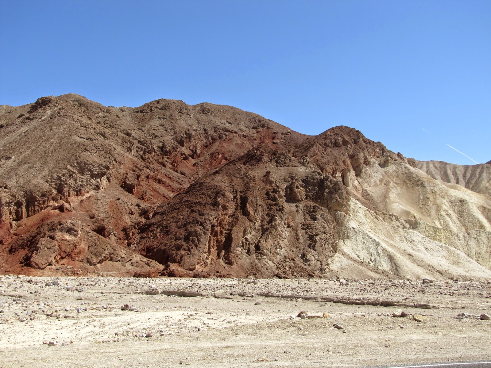
From the Furnace Creek Visitor Center we started our drive down Badwater Road. Traffic was fairly light, so we could take our time as we wanted to. If you ever do this drive, I 100% recommend you do the detour on Artist Drive. It's a one-way loop road that takes you through some amazing rock formations. It was a highlight of the day!
You can see the map of our route here... Overall our drive was just under 300 miles. We continued down Badwater road to Shoshone, California. This was our dinner stop, at the Crowbar Cafe. For a little place in the middle of no where, they had some really, really good food.
From Shoshone, we crossed the border back into Nevada and came back into Pahrump. We had some more geocaching planned for here. There was a series of caches strung out through the desert east of town and we hit as many as we watched a beautiful sunset. We didn't mind driving back to Vegas in the dark, since we had driven through the same route that morning in the daylight.
The beauty of Death Valley is a vastness that makes you realize just how small you are.
We spent a lot of time in the desert on this trip, and previous trips. The amazing thing to me is the variety of different environments that you see. From sand and cactus to rocky landscapes to salt flats. To just say "desert" is a very broad term..
Speaking of salt flats... We took a short side trip the Devil's Golf Course. This was an amazing spot!! Death Valley was a prehistoric lake, and as the water evaporated it left behind the salt, which formed in this jagged, bizarre landscape. And I do mean jagged. I did a little walking around, but had to be very careful about it. If a person fell, you'd cut yourself up pretty bad.
From a distance, the salt flats looked the tidal mudflats we have here in Alaska.
You almost expected to see the tide come in... And when we stopped, I was anticipating that smell that tidal flats have.
Badwater Basin is the lowest point on the North American continent, coming in at 282 feet below sea level. there's a natural spring here, but because it's in the middle of a salt flat, it's too salty to drink and couldn't be used to water animals.
This is a popular spot for people to walk out on the salt flats. As people have walked out, they've ground the salt into a fine powder that looks like a developed trail.
On the rocky cliffs above, you can just barely make out a sign marking sea level. You can click on any of these pictures to enlarge them.
I feel very blessed to have been able to experience some amazing places, and Death Valley is certainly one those places. I hope some day to make it back to explore even more.

Jan 20, 2013

Valley of Fire

Right after Thanksgiving we spent a week in Southern Nevada and did some exploring. Our biggest day included visiting Hoover Dam and then driving along Lake Mead to Valley of Fire State Park. You can see the Hoover Dam story here in my earlier post...  
And here's link to the map of our route that day....
We could have spent the entire day here, but we didn't actually make here until late in the after noon. We spent more time at the dam than we planned and then took our time driving up along Lake Mead. We just barely made it through the park before it got dark.

As you can see from the map of our journey we did the trip as a big circle. You can find more information about the park at their official website, or at the Wikipedia article. I won't take the time here to give all facts & figures here since they are easily found on the linked pages.

 These pictures show probably the best part of our drive through. It was towards the end of the day and the sun was headed towards the horizon. We had taken a bumpy side road to see Arch Rock. After getting a good photo of it, we loaded back up in the car and headed towards the park exit. We came around a corner, and this guy was on the rock dead ahead of us.


We did a little freak out... I'm yelling "look, get a picture", Christy is trying to get out of the car to take the picture, but I've neglected to actually stop the car because I'm too busy telling her to get a picture.
We finally got stopped and got out of the car and a second one showed up. These are big horn sheep. We watched them for about 5 minutes before the went over the other side of the rock.
 This is the Arch Rock we had taken the side road to see. The rock formations in this park were impressive.
 Some of the wonders in the park are man made. These petroglyphs, or rock art, where made by Native Americans around 1,500 years ago. A great discussion on these fascinating markings can be found here...
To reach the petroglyphs you had to climb up an extensive set of stairs. These are a more recent addition. They were a nice replacement for the narrow steep steps that had been carved into the rocks at some point.

From here, I'm going to let the pictures speak for themselves...


 I love the contrasting colors in this picture. Christy takes amazing photos.