Jun 28, 2014

So many Geocaches...

June 25th marked the 9th anniversary of our first geocache find. (You can read  how we got started here...)
We've been trying to average 100 caches per year. Right now we are a little ahead of the curb, with 929 finds. We have cached in 28 states and two countries and have traveled 78,760 miles in our geocaching journeys.
Here's what it looks like in Google Earth:

Here's the map of states (and 1 Canadian territory) that we've cached in:
Here's some various other statistics:


Profile for AKStafford

Jun 19, 2014

The Road Trip - Zanesville


 One of the stops on our 15 state, 3,235 miles, ll day road trip was Zanesville, Ohio. A Y-shaped bridge (called the "Y-Bridge") spans the confluence of the and rivers. Listed on the National Register of Historic Places, it is one of very few bridges of its type in the United States.

The Y-Bridge is located downtown and enables locals to give tourists directions that include “turning left or right” in the middle of the bridge. The Y-Bridge has been an aviation landmark for many years. Amelia Earhart was quoted as saying, “Zanesville is the easiest recognized city from the air because of the Y- Bridge.
Zanesville was named after Ebenezer Zane, who had constructed Zane's Trace, a pioneer road from Wheeling, VA (now part of West Virginia) to Maysville, KY through present-day Ohio. In 1797, he gave land as payment to his son-in-law, John McIntire, at the point where Zane's Trace met the Muskingum River. With Zane's help, McIntire platted out the town and opened an inn and ferry by 1799. In 1801, Zanesville was officially renamed from Westbourne (Zane's chosen town name).
Novelist Zane Grey, a descendant of the Zane family, was born in the city. He grew up in Zanesville; from an early age, the boy was intrigued by history. His first three novels recounted the heroism of ancestors who fought in the American Revolutionary War.


Jun 16, 2014

The Road Trip - Bristol Motor Speedway


So in the last part of May we flew from Anchorage to Chicago and kicked off an 11 day road trip. In that time we cover 15 states and drove 3,235 miles. I don't know that I would do that trip again, and I don't think I've recommend it to others, but we had a great time. We got to see A LOT of country, traveling along the Appalachian Mountains.

The plan is to do a series of post sharing the pictures from the trip. It's going to be kinda random but hopefully you'll enjoy it. I think I'm going to start with our time at Bristol Motor Speedway.
Full Disclosure: A good chunk of the text below was copied & pasted from Wikipedia.
Bristol Motor Speedway is the 4th largest sports venue in America and the 8th largest in the world, housing up to 165,000 people. The track is so short that speeds here are far lower than is typical on most NASCAR oval tracks, but they are very fast compared to other short tracks due to the high banking.
 We took a $5 hour long track tour that was well worth the money. For part of the tour they stopped and let us walk up to the top of the bank. It's hard to see in the picture, but it is steep, measured at about 26 degrees.
The tour also took us up to the owner's suite. It was pretty impressive. The track is ringed with suites overlooking the track. Most of them are leased by large corporations and sponsors and offer the chance to watch the race in style.
Right now the infield is painted with football field grid. On October 14, 2013, after years of attempts to schedule a game, Virginia Tech, UT, and Bristol Motor Speedway announced plans for the game to be held on Saturday, September 10, 2016. Organizers envision attendance for the non-conference game, dubbed the Battle at Bristol, College Football's Biggest EVER, to draw 150,000 spectators, which would surpass the current NCAA record for highest single-game attendance.
 The track is so small that "Victory Lane" sits on the roof of one of buildings. We got to go up here and take some more pictures. With all of these pictures, you can click on them for a larger version.


May 9, 2014

Scout Ridge & The Palmer Hay Flats at Cottonwood Creek

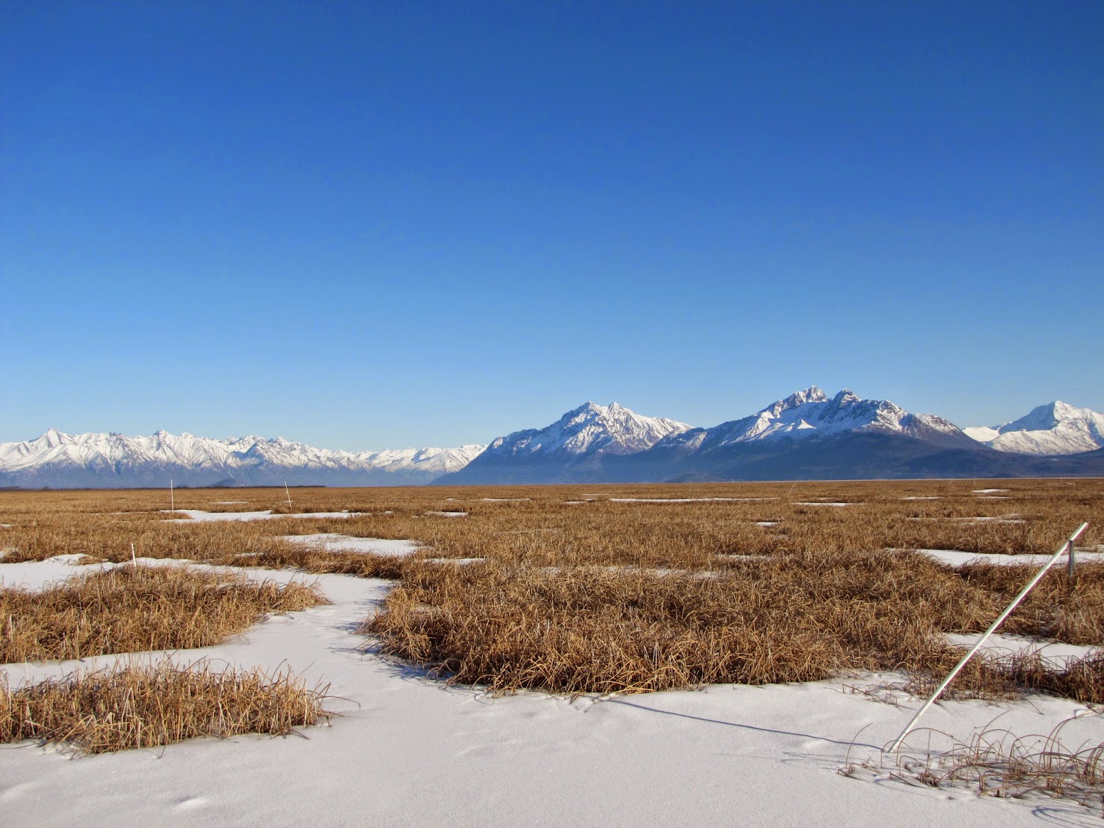
In early March I took a couple of hours to walk around one of my favorite areas here in the Valley: the Palmer Hay Flats. The weather was perfect.... It was sunny & warm enough that I didn't need any heavy clothing. In the summer this area can be swampy, but in the winter the ground is completely frozen and great for walking on.

You can access this area by traveling down Fairview Loop and onto Hayfield Road. A map link is here....
Once your turn off of Hayfield road, you'll drive a short way down a narrow gravel road. There's an upper parking area for accessing Scout Ridge and then a hill down to the lower parking area for accessing the flats.
A recently installed pedestrian bridge provides easy access over Cottonwood Creek. In the summer, salmon swim up this stream on their way to the spawning grounds. Unfortunately at this point the stream is full of glacial silt and the fish would be hard to spot.
  On the other side of the bridge they've installed geotiles for a hundred yards or so... This provides for stable walking year round. If you are in the area and looking for some beautiful vistas, you can walk out a little way without your feet getting too wet.

High above the flats is Scout Ridge. A viewing platform provides the perfect place to sit and take in the scenery. It's easily reachable from the upper parking area.
So the next time you are looking for beautiful vistas, rugged mountains and everything that is Alaska, swing by the Cottonwood Creek access point. You won't regret it...