Mar 30, 2018

Bryce Canyon National Park

We've made two visits to Bryce Canyon National Park... The first time was on a trip in 2015 when we went there on a whim while visiting Zion. We didn't have much time so we just hit the view points on the rim of the canyon.
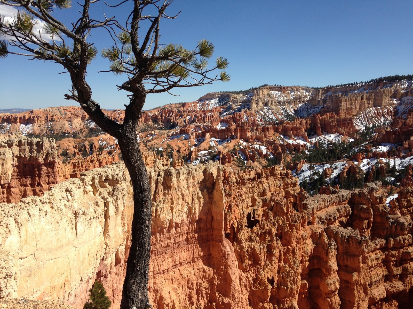
 And just from that few hours we knew that we'd have to come back when we had more time. The views were amazing. Bryce Canyon is famous for it's hoodoos, the tall spires of rock.
 Our visit in 2015 was in March and the winter's snow was still lingering in the canyon. Many of the hiking trails were still closed, but we didn't have time for hiking on that trip anyway.
Even if someone is unable to hike much, just viewing the canyon from the viewpoints on the rim is well worth the effort.


In 2017 we made another swing through southern Utah, this time coming from the east. Based on the research I had done on TripAdvisor I knew that we wanted to check out the Mossy Cave Trail just off of Highway 12. (And just a tip... If you are coming to Bryce from the east, say from Moab, you want to take Highway 12 from Torrey. Talk about scenic!)

From the small parking area a trail heads off following a small stream, crossing it twice on bridges. Since the trail is so easily accessed and is not a long hike, I planned on there being crowds of people enjoying the sights. But it was almost like we had the place to ourselves.
 We passed one couple when we were going up and had another couple wandering around at the falls. On the way out we passed a small family headed up.
The goal was the waterfall. I can not image a more perfect location. I could've spent hours just sitting here; but we had a lot more we wanted to see and do.
As we came into the Park on Highway 63 we made a stop at the Bryce Canyon Visitor Center. I have found the Visitor Centers at our National Parks are all well put together and well worth a stop. But again, we had a purpose & a plan and had to get to it.


 Our goal was to get below the Canyon rim. The Canyon is laced with trails for hiking. There's also some horseback options. We decide to put our limited physical abilities to the test and do the Queens Garden Trail and connect to the Navajo Trail.
 This route would be about 3.2 miles. Basically it worked out to 1.3 miles of going down into the canyon and 1.8 miles coming back out. The elevation change was about 550 down and 550 back up.
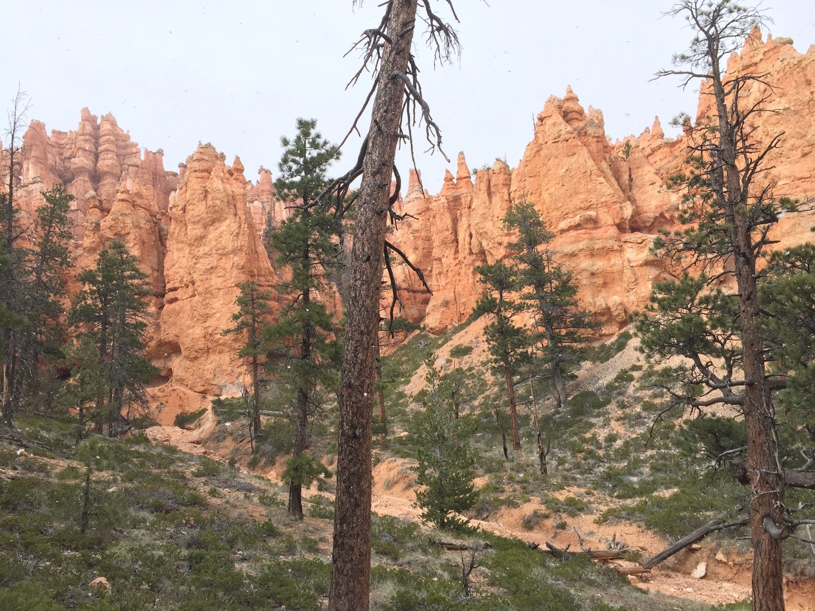
And as impressive as the view from the Canyon rim was, being down among hoodoos was awesome. The rock formations towering over you made you realize how small you really are...
We started the Queen's Garden trail at Sunrise Point, leaving our car in the parking lot near the general store.


 Coming down at the beginning of the trail the way we did we saw minimal traffic until we were coming back up out on the Navajo Trail.  I'm amazed at how few people want to wander more than a few hundred yards away from their cars. Look people, we are fat and we do it... Get out there and enjoy God's creation!
 The trail was well established and easy to follow. And of course the views continued to amaze.
Obviously you'll want to bring plenty of water. Also, there were no restrooms along the way, so plan accordingly.
Have good walking shoes. And if it's hot, don't be afraid to stop and rest.
 We didn't plan it, but we had some great sunlight for coming back up. And this was the busiest part of the trail. Many people start from this end at Sunset Point and just go down and back up. The trail here is a series of switch backs where you painfully pay for each foot of elevation.


 Slowly you wind back and forth. Since this was the end of our hike we were pretty much at the end of our strength. Plus we had walked a couple of miles earlier that day at the Mossy Cave Trail. Plus the walking we had done in the previous days at Capital Reef National Park, Arches National Park, Canyonlands National Park & Goblin Valley State Park.
So we were moving pretty slow. There was a couple of bus loads of teens coming back zooming past us. But you just keep putting one foot in front of the other....
And of course pausing often to admire the views...


After reaching the top at Sunrise Point, we made our way back only the Canyon Rim trail to Sunset Point and our car.

Mar 16, 2018

Colorado National Monument, Utah Highway 128 & Canyonlands National Park

Our trip was in April of 2017. We flew into Denver, Colorado and drove as far as Grand Junction that first day. The second day we took the scenic (and I do mean scenic) route from Grand Junction, Colorado to Moab, Utah. You can see a map of our route here... I got the suggestion of adding the Colorado National Monument & Highway 128 from the TripAdvisor Forums, which I highly recommend for travel planning. (I used the Colorado & Utah forums for this portion of the trip)

We were hitting enough National Parks on this trip that having the America The Beautiful Pass made a lot of economic sense. We saved over $100 with it.
If you are a senior you can get a lifetime pass for just $80 and kids in the 4th grade can get an annual one for free!


The Colorado National Monument is worthy of more than just a drive through on Rimrock Drive, but that was all we had time for. We made a few stops at the pull offs for pictures.


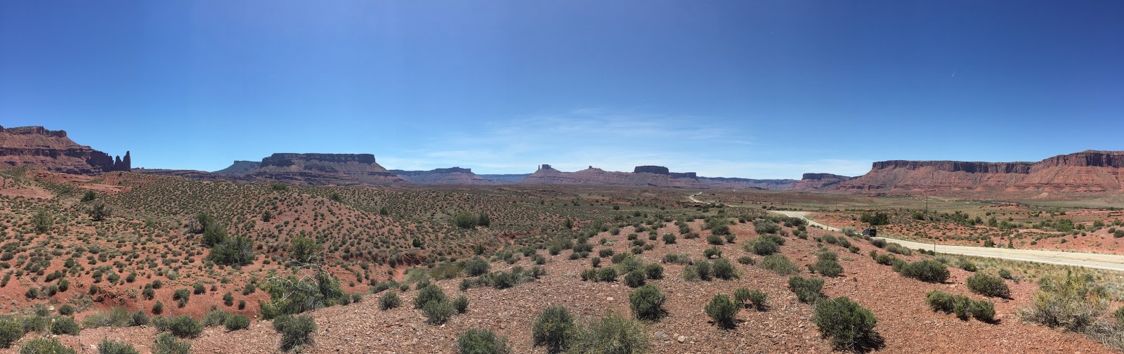
 After we finished the drive we got back on the Interstate and crossed into Utah. But we weren't on the Interstate for long. We got off and took Highway 128 along the Colorado River. This historic route was the highlight of our day. Traffic was light so we could stop as often as we liked to enjoy the view.


We got into Moab that evening. We still had a few hours until sunset and we had our America The Beautiful Pass and Canyonlands National Park was right there. So....


Aug 13, 2017

Spencer Glacier via the Alaska Railroad

In late July the wife & I celebrated our 18th anniversary. Months earlier I had started saving money for an Alaskan adventure that I had wanted to do for a long time.

The Alaska Railroad's Chugach Explorer Train
You see, it's not just the tourist that enjoy Alaska. Us locals like to get out and explore our home too. The Alaska Railroad offers Glacier Discovery Train takes you to the Spencer Glacier Whistle Stop. Departing from Anchorage in the morning, it makes a stop at Portage and then onto Whittier and then back to Portage. From there it heads into the Chugach National Forest and stops at the Spencer Glacier Trailhead. From there it continues onto the Grandview area and then heads back, stopping again at Spencer Glacier and then along side the Placer River to pick up those who have traveled downstream by raft. Then back to Portage, Whittier, Girdwood and finally Anchorage.

Because of the multiple stops, people use this train for multiple reasons. Cruises headed to Whittier can use this train to get to their ship. Or you can do a Prince William Sound glacier cruise. We caught the train at Portage when it stopped there the first time and road along as it went to Whittier and back. We could've caught the train when it stopped in Portage the 2nd time, but it was nice to just relax as the train rolled along. And while we were stopped in Whittier, we had enough time to bag a geocache.

Yesterday's rafts being pick up for today's rafters.
At our 2nd stop at Portage, we picked up the bulk of the passengers. Most were part of a tour group. From Portage to Spencer Glacier is a quick trip of about 30 minutes. This includes a few moments alongside the Placer River to pick up the rafts that had been left there yesterday to be used today. These rafts are surrounded with an electric fence to keep curious bears from damaging them.
Then it was onto the the Spencer Glacier stop where most of us got off. A few people stayed on for the trip to the Grandview area. This trip is suppose to be beautiful and someday I hope to do that too. In additional to the Spencer Glacier stop, the US Forest Service and the Alaska Railroad plan to develop several more stops in the future.

The level, easy 1 mile trail at the Spencer Glacier
At the Spencer Glacier stop you disembark at the head of a one mile gravel path. There's a couple of covered pavilions with interpretive panels and outhouses here. Those going rafting were met by their guides and loaded on a bus. They made a short trip up to the lake formed and fed by the Spencer Glacier that serves as the headwaters to the Placer River. After rafting among the ice bergs born of the glacier, they float down the Placer River to be picked up by the train on the way back. This looks like a fun trip too.


Always good advice...


This bridge over the Placer River connects to what will be additional trails
Most of those not rafting rallied around the Forest Service ranger for a ranger guided walk to the lake. I'm sure this was informative, but we had a different agenda. We have been geocaching for 12 years and were just a few caches away from having found 1,200 caches. There was a string of caches along the trail that would get us over the mark, so after the crowd (and by crowd there was maybe a dozen people...) moved on, we started our hunt along the trail. The walk was Alaska at its finest with mountain views, lush greenery, and the river humming by. And bugs. Not mosquitoes, but these little black flies. They didn't seem to bite, but having a cloud of these things around your head would almost drive a person nuts.


Spencer Lake and Spencer Glacier
After a mile on the gravel path and 5 caches, we came to the lake. The view across to the glacier was majestic. Ice bergs serenely floated on the lake. Our fellow travelers spoke among themselves quietly, almost as if they were in a cathedral and respecting the sacredness of the surroundings. At the lake edge we found geocaching number 1,200 and soaked in the views.


A few people brought mountain bikes to explore on. The trail continues past the lake to a public use cabin. Nearby is a camping area for those who wish to spend a few days here. But alas, our time was short, almost too short. We walked back do the trail and waited just a few moments for the train to arrive. We loaded up and found our seats. The train continued on, pick up the rafters and then arrived at the Portage stop. We got off here where our car was parked. There was a motor coach waiting to take other travelers to Girdwood and Anchorage while the train would continue on to Whittier again to pick up those who had done a day cruise or were coming off a cruise ship. You can stay on the train if you don't mind a late return to Anchorage.

We hopped into the car and headed to Girdwood to overnight in the Alyeska East 210 condo offered by Alyeska Accommodations. It was a nice place with a great view of the mountains and very affordable for Alaska in the summer. We enjoyed dinner at Silver Tip Grill and walked around the Alyeska Resort area at the base of the ski hill. Then it was off to bed.We had more adventure planned for the next day, which you can read about here...

Byron Glacier Trail

For our 18th anniversary in late July we decided to have an Alaskan experience. For the first half of our weekend, we did the Spencer Glacier Whistle Stop trip on the Alaska Railroad and overnighted in Girdwood. You can read about that here...

After waking up we left Girdwood and headed to the Portage Glacier Valley in the Chugach National Forest. This is one of my favorite areas and we've spent time here in the past. ( Hiking Portage Pass, the Portage Glacier cruise, gulls trying to kill us.... ) But one thing we've never done was the Byron Glacier Trail hike. The Byron Glacier Trail begins as a 1 mile gravel trail over flat terrain. It's easy walking and on the weekend we went it was well traveled. As with anywhere in Alaska, you want to be "bear aware" and use all the proper precautions.

Byron Creek looking towards Bear Valley
The trail officially ends on the creek bed of Byron Creek. But really, that's where the fun begins. You can get some great views here and if your mobility is limited or you are short on time, just walking this far is worth it. But if you can and you've got the time, keep going. The glacier is another couple of miles up the valley. If you had the skills, I bet getting up to it is amazing. We just went another mile and every step we took the view got better and better.

You could see evidence of last winter's snow coming down into the valley in an avalanche. Many people were running around on the snow. Many tourist that come to Alaska are coming from locales where snow is non-existent, so this is a treat for them. But do use caution. The creek is running under that snow and I don't think it would be impossible to break through under the right conditions.

Waterfalls coming down from the glacier
Directly in front of us was a small mound of shale pushed up by the glacier. A well worn path led to the top and I figured that would be a great place for a photo. From there I could see beyond that was a large mound of rocks and boulders that over the years had cascaded down from the mountains on both sides. It looked like it could be a tough scramble for two chubby people, but I knew I had to go further. So onwards we went. Most people were staying within a hundred yards of the end  of the trail, but there was few going further; including families with young children. So I knew that it wasn't impossible.

We made our way up and over the mound, pick our way through large chunks of rock. The creek flowed around the mass to the east and I could see one person making their way alongside it. There was no real path; you simply went whatever way you could.

We pushed onto another snow field, crossing the creek to get to it. At that point the terrain began to get increasingly steeper. We had already gone much further than originally planned and knew that it was probably time to turn around. This time we went around the mound along the creek. It certainly wasn't any easier, but being right next to the roaring water was a great experience.

As we got back to the trail, I wanted to shout to those there" hey, go up just a little further! It's worth it!". But I figured each person explores in their own way and left it at that. We got on the trail and made our way back to the car. Our incredible weekend  was coming to close. It was a great way to celebrate a milestone and I'm looking forward to many more adventures with the wonderful gift that is my wife.

A few tips for Byron Glacier: the parking area can fill up. You can find more parking at the end of the road where the Portage Glacier Lake cruise departs or at the Begich-Boggs visitor center. Or wait a little bit. It seemed like there was a lot of turnover. There was no cell service in the area. The only food in Portage Valley is at the Portage Glacier Lodge. It's soups and sandwiches. I haven't eaten there in years, but in the past they've had great food.